044 209 91 25 079 869 90 44
Merkliste
Die Merkliste ist leer.
Der Warenkorb ist leer.
Kostenloser Versand möglich
Bitte warten - die Druckansicht der Seite wird vorbereitet.
Der Druckdialog öffnet sich, sobald die Seite vollständig geladen wurde.
Sollte die Druckvorschau unvollständig sein, bitte schliessen und "Erneut drucken" wählen.
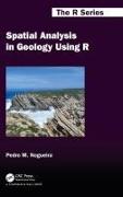
Spatial Analysis in Geology Using R
ISBN/GTIN

Spatial Analysis in Geology Using R

BuchGebunden
Verkaufsrang123inGeowissenschaften
CHF129.00

Beschreibung

Empowers you to harness the potential of spatial analysis in addressing pressing geological challenges. Can also be used as a textbook either in introductory courses in spatial analysis or in advanced GIS and Digital mapping - comprehensive guide tailored to professionals at all levels.
Weitere Beschreibungen

Details

ISBN/GTIN978-1-032-65032-6
ProduktartBuch
EinbandGebunden
Erscheinungsdatum01.07.2024
Auflage1. A.
Seiten428 Seiten
SpracheEnglisch
MasseBreite 156 mm, Höhe 234 mm
Gewicht1000 g
IllustrationenFarb., s/w. Abb.
Artikel-Nr.50954662
KatalogBuchzentrum
Datenquelle-Nr.45761428
Weitere Details

Reihe

Über den/die AutorIn

Pedro Nogueira received his undergraduate and PhD degrees in Geology from Porto University. He completed the curricular part of an MSc in Engineering Informatics at Évora University. From 1997 to 2022, he was Assistant Professor at Évora university and currently holds the position of Associate Professor. He has more than thirty years of experience as a field geologist and mineral resources specialist. Pedro has worked in diverse countries such as East Timor, Mozambique, and the Dominican Republic. He has published more than 30 peer reviewed papers in international journals and has served as an editor of several books and book chapters.

Pedro is a full member of the Earth Sciences Institute and has participated or served as a project leader or researcher, in more than 15 funded projects, several of which are internationally run. His current research interests are centered around the study of gold, copper, iron, and rare earth mineral deposits, interweaved with geochemistry, geophysics, remote sensing, and spatial data analysis - spatial intelligence.